This is what pilots see when landing at Offutt Air Force Base in Nebraska

August 7, 2013 at 5:00 pm

Apparently this is the handy work of a patriotic farmer cuts this message every year, with the aid of a GPS in his tractor. Should put a smile on the face of the pilots every time they see this one. Pretty cool stuff!

Image Source: Imgur via Reddit

Honk your parking woes away – App Saves You From Tickets, Remembers Parking Spots

February 21, 2013 at 6:25 pm

Say hello to Honk, a neat little app (now available on iOS platform for $0.99) that solves two of the biggest headaches (especially in urban environments that you are unfamiliar) – remembering where you parked and also remembering if your meter time is up.  Here are some  of the features as mentioned in the app store:

  • Simplest interface to set the parking meter alarm. A single swipe for most situations!
  • Updates your remaining time on its App Icon. A quick glance at your home screen, your mind at peace.
  • Smooth handwritten memo/photo/voice memo to mark the parking spot.
  • Honk uses the highest level accuracy available for the phone and marks your location when you set the meter alarm automatically. Manually move the parking pin on the map when the GPS accuracy falls short. Shows how far the car is from your current location.
  • Innovative bread-crumb trails to help quick orienting yourself as well as built-in compass.
  • Different types of meter with long (up to 24 hours) and short time limits.
  •  Soft, regular as well as the Library- and the Shopping Mall- alarm level options.
  • Uses the background processing and local notifications for reliable, accurate alarms. Supports Retina display.

Pretty cool, right? Check out the little video from Mashable that explains all this:

When Swarms Talk to Drones – Evolution of Robotics Is Approaching Scary Levels (And It is Awesome)

October 25, 2012 at 6:15 pm

There are many exciting developments in the world of robotics and here is one from the European Union, funded under the EU’s  7th Framework Programme.  The video below shows how a drone can take over command and control responsibilities of a swarm on the ground, without any external communication channels like GPS (i.e., Spatially Targeted Communication and Self-Assembly).  Some of the example applications shown here are cool, i.e, moving chairs, bringing snacks to a guy watching TV, pushing the water container, etc.  But this one has far more devastating implications when deployed for the military in remote battlefields.

Motorcycle Diaries: Part II (sans Che’) – Beautiful photo essay from a foreigner who rode 12,500kms through South America on his 150CC motorcycle

June 22, 2012 at 11:56 am

Imgur via Reddit

Awesome road trip story as narrated by Redditor rufflesdance… with NO GPS!  If you are an avid motorcyclist and harbor a desire down in the trenches of your mind, I sincerely recommend you to check out the comments section of his Reddit post where he has shared info. and answered tons of questions from fellow motorcycle enthusiasts. It was mindboggling how much he has learned and observed as he shared many little nuggets of wisdom from this road trip. If you have a hard time reading the detailed narrative underneath each of the photographs, click here. Drop a note in the comments section if you like this post.


Google Maps Feature, Transit Navigation (Beta), Lets You Know When To Get Off the Bus/Train (as long as you are not underground)

July 6, 2011 at 7:10 pm

(Source: Youtube via Jalopnik)

Google Maps 5.7  is now available with a deeper public transit navigation for users in nearly 400 cities around the globe. As shown in the above video, using your location along the route, the Transit Navigation feature on Google Maps will alert you when its time to get off at your destination or to make a transfer. Transit Navigation (Beta) requires a phone with Android 2.1+ (too bad, Apple users are missing out here) and the latest update of Google Maps for mobile. Oh, the only caveat is that the system works only for above-ground transit systems where the GPS signals can be reached.  And for those with plenty of time to spare, here is a hands-on review of the new feature, courtesy of Engadget. I can already surmise this is a god’s gift (or Google’s) for the international travelers.

Counting the kills! California’s roadkill data crowdsourced from citizen observers

September 13, 2010 at 5:29 pm

Sometimes people ask me what I do at work.. I wish I can say something like this: “I’m Doctor Roadkill. I collect and upload roadkill data to the California Roadkill Observation System, a mapping Web site built by researchers at the University of California, Davis, to better understand where and why cars strike animals.”

Amplify’d from www.nytimes.com

Begun a year ago, the Web site — www.wildlifecrossing.net/california — is the first statewide effort to map roadkill using citizen observers. Volunteers comb the state’s highways and country roads for dead animals, collecting GPS coordinates, photographs and species information and uploading it to a database and Google map populated with dots representing the kills. The site’s gruesome gallery includes photos of flattened squirrels or squashed skunks.

The site’s founders hope to soon hire a software engineer to design a smartphone app. They think one would attract new and younger volunteers, speed up the process, and, with built-in GPS function, assure more accurate location information.

About 73 million GPS-enabled cellphones and 23 million automotive GPS units will be shipped in the United States and Canada this year, according to IMS Research, a market research firm. “GPS is very pervasive,” said Bill Morelli, an analyst with the firm.

The roadkill maps give researchers a better understanding of the environmental impacts of roads. They intend to use the data to build statistical and Geographic Information Systems models to predict roadkill hot spots and to determine where animal road crossings, culverts and warning signs may be most effective on current and future roadways.

Read more at www.nytimes.com


NYC, get ready for iPhone powered social bike sharing program

August 11, 2010 at 9:35 pm

Now, that’s what I call innovative… Good stuff.

Amplify’d from www.engadget.com
Social Bicycles is a bike sharing system with a twist. Using an iPhone app, the system allows users to drop off, locate, and borrow a bike nearly anywhere. The bikes are equipped with a GPS device which is locked to one of the wheels, and when the bike is locked, it’s locatable using the app, so that someone can borrow it; when it’s in use and unlocked, it doesn’t appear in the app. Read more at www.engadget.com
 

Study says GPS-systems with real-time traffic info can save a lot of time

August 30, 2009 at 11:54 am

(Source: NAVTEQ via Autoblog)

According to a new study, GPS-systems with real-time traffic info can save American drivers four days a year of being stuck in grizzly traffic snarls. As promising as it sounds, this particular study should be viewed with a little bit of skepticism because it was sponsored by navigation systems data-provider NAVTEQ.  Here are some of the study details (as published in the NavTeq press release).

The results are from a three pronged studies conducted in two metropolitan areas of Germany – Dusseldorf and Munich — which evaluated drivers without a navigation system, drivers with a navigation system, and drivers with a navigation system that included real-time traffic. Previous studies in this field focused more on “getting lost” scenarios versus the benefits to drivers of navigation system use during the course of their normal driving habits.

The study revealed that the drivers using traffic enabled navigation devices experienced dramatic time savings, spending 18% less time driving on an average trip versus drivers without navigation. If applied over the course of a year, a driver who does not currently use a navigation device would save themselves 4 days of driving each year if they had a traffic-enabled navigation system. Additionally, the findings show that drivers with real-time traffic experience reductions in distance traveled as well as increase fuel efficiency which would lead to a decrease in CO2 emissions per driver of .79 metric tons, or 21% less than a driver without a navigation system.

These results not only point to the positive impact on German drivers, they can be projected to other countries as well, for example*:

  • UK drivers with traffic enabled navigation would save 2.5 days per year and drop their CO2 emissions by 20%
  • US drivers with traffic enabled navigation would save 4 days per year and lower their CO2 emissions by 21%

Click here to read the entire press release.

Navigation Device Gone Wild! American tourist in Germany follows outdated GPS into oncoming traffic

June 29, 2009 at 10:39 am

(Source: The Local, Germany)
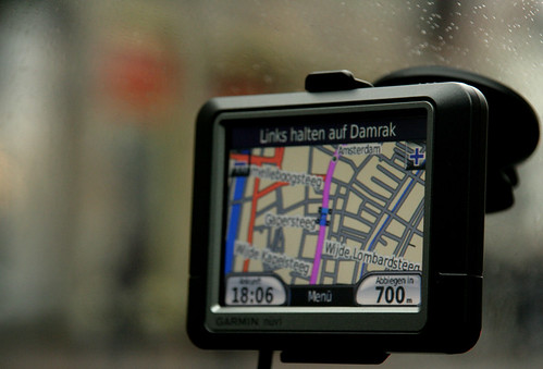
Image Courtesy: Apture

An American tourist caused an accident near Karlsfeld over the weekend, banging up some €45,000 in damages when he followed an outdated navigation system prompt in the wrong direction, daily TZ reported on Monday.

According to the paper, the man’s Mercedes Vito rental car system had not been updated with the new exit from the B471 motorway near Karlsfeld, 20 minutes north of Munich.

The oversight caused him to drive himself and seven passengers into oncoming traffic, where they came face to face with a Peugeot. Both cars wound up veering off the road and into a ditch, the paper said.

The Vito landed on the roof, but all eight passengers in the Mercedes escaped injuries. The Peugeot driver suffered a whiplash injury.

Click here to read the entire article.

Smart Black Box – Coming Soon to a car next to you!

June 25, 2009 at 11:45 am

(Source: Wired)

Image Courtesy: Wired

A company that provides communications systems to law enforcement agencies around the world has developed a black box similar to those used in aircraft to record crash data in cars.

The Smart Black Box by KCI Communications sticks to your windshield and uses a built-in camera, GPS unit and G-force shock sensor to document accidents. The info could come in handy when trying to determine fault or explain to your insurance company just what happened when you crunched your car.  KCI says the GPS unit will record the time and location of an accident and document your speed and direction of travel. The company says that could be useful when trying to prove that red light you ran was actually yellow or in cases where you dispute the reading on a cop’s radar.

The Smart Black Box costs about $300 and constantly records video footage on a loop as you drive. Should the shock sensor detect an accident, the device saves the 15 seconds prior to impact and the 5 seconds afterward. The footage is saved to a SD Card, like that found in your digital camera, making it accessible on a home computer.

Click here to read the entire article.