TSAG Case Studies Workshop and Webinar: A Rural Emergency Incident
 Utah US Route 163 Motor Coach Crash – August 26

August 4, 2009 at 10:40 pm

Webinar Overview

TSAG logo

TSAG Case Studies Workshop and Webinar
A Rural Emergency Incident
Utah US Route 163 Motor Coach Crash

Date: August 26, 2009
Time: 9:00 AM–12:00 Noon, Pacific Time (12:00 – 3:00 PM EST)
Cost: All T3s are free of charge
PDH: 3.0. — Webinar participants are responsible for determining eligibility of these PDHs within their profession.
Register On-line
Contact the T3 Administrator

Note: This workshop and webinar is a unique learning opportunity offered by the Transportation Safety Advancement Group (TSAG) and the ITS Professional Capacity Building Program’s Talking Technology & Transportation (T3) Program at the ITS Joint Program Office, U.S. DOT. The workshop will be presented to a live audience at the workshop location as well as to remote T3 webinar participants. T3 participants are invited to submit written questions before the Webinar as well as during workshop question and answer periods.

Webinar participants may attend remotely for any portion of the 3-hour workshop. An audio of the event’s proceedings, synchronized with its presentations, will be available in the T3 Webinar archives approximately 4 weeks after the workshop.

Background

The Transportation Safety Advancement Group (TSAG) is facilitated and administered by the Intelligent Transportation Society of America (ITS America). Through its Workshop series and related work, TSAG provides input to the US Department of Transportation (US DOT), ITS Joint Program Office’s public safety mission. TSAG advises the ITS Joint Program Office on the development and deployment ITS technologies that optimize travel mobility, safety, economy, and environmental quality. Through its broad based membership comprised of transportation and public safety professionals, TSAG initiates programs that promote inter-disciplinary, inter-agency and inter-jurisdictional coordination and cooperation, and that promote partnerships for advancing surface transportation services technologies. For more information, visit the TSAG website.

TSAG operates through resources provided by the US Department of Transportation and serves its program mission in compliance with US DOT regulations, policies and specified contract provisions.

Utah US Route 163 Motor Coach Crash

On January 6, 2008, at about 3:15 p.m. MST, a fifty-six passenger motor coach with a driver and 52 passengers on board departed Telluride, CO, en route to Phoenix, AZ, as part of a 17-motorcoach charter caravan returning from a 3-day ski trip. The normal route from Telluride to Phoenix along Colorado State Route 145 was closed due to snow and the lead caravan driver planned an alternate route that included US Route 163/191 through Utah.

At about 8:02 PM, the motor coach, traveling southbound was descending a 5.6-percent grade leading to a curve to the left, 1,800 feet north of milepost 29 on U.S. Route 163. The weather was cloudy, and the roadway was dry. After entering the curve, the motor coach departed the right side of the roadway at a shallow angle, striking the guardrail with its right-rear wheel and lower coach body about 61 feet before the end of the guardrail. The coach traveled some 350 feet along the fore slope with the right tires off the roadway. The coach overturned, striking several rocks at the bottom of the embankment and came to rest on its wheels. During the 360-degree rollover, the roof of the motor coach separated from the body, and 50 of the 53 occupants were ejected. As a result of the crash, 9 passengers were fatally injured and 43 passengers and the driver received injuries, ranging from minor to serious.

Case Studies Workshop & Webinar Overview

Case Studies Workshop presenters will walk the audience through the details of the incident, including pre-crash, crash, and post-crash conditions and activities. The Workshop will focus on emergency response and management strategies and technologies, including communications between and among Police, Emergency Medical Services Utah DOT Transportation Operations personnel. Workshop presenters will discuss successes, failures and lessons learned and will highlight emergency response activities of local and regional emergency responders and will review operations strategies and technologies at the time of and in response to the incident.

Target Audience

Workshop participants include TSAG members, NRITS registrants, the T3 Webinar/ITS community, and other guests. Webinar target audience includes state and local public safety interests, including public safety managers and transportation operations, emergency communications, and emergency public safety practitioners. Additionally, private and academic and safety and technology research interests are encouraged to participate.

TSAG Case Study Workshop Concept and Purpose

The TSAG Case Studies Workshop concept targets case-studies of actual incidents or events associated with each of the eight (8) TSAG interest-community teams. TSAG communities of Interest include:

  • Academic & Research
  • Emergency Communications
  • Emergency Management
  • Emergency Medical Services
  • Transportation Operations
  • Fire and Safety
  • Law Enforcement
  • Technology and Telematics

Thus, through reviews of actual recent events, incidents, and first-responder experiences, Case Studies Workshops facilitate after-event discussions by multi-discipline and multi-agency professionals for the purpose of:

  • Clarifying actual circumstances of the event / incident
  • Reviewing established response protocols and procedures
  • Reviewing public safety technology applications
  • Identifying unique management and response circumstances and challenges
  • Reviewing successes, failures, and lessons-leaned

The TSAG Case Studies Workshop & Webinar series is focused on the fundamental TSAG “technologies for public safety” TSAG mission.

Learning Objectives

The broad learning objectives of the TSAG Case Studies Workshop series include:

  • Identify transportation-safety technologies and their real-time applications to operations surveillance and management
  • Identify incident identification, emergency response and management
  • Identify inter-agency and inter-discipline coordination and communications
  • Learn of technology successes, failures, and lessons-learned

Federal Host:

Linda Dodge, Chief of Staff, US DOT, ITS Joint Program Office

Workshop Presenters:

John Leonard, Utah Department of Transportation

As Traffic & Safety Operations Engineer, John Leonard evaluates the operational characteristics of projects, and coordinates their safety and efficiency aspects with UDOT project teams to determine that operational safety objectives are addressed. He participates in project reviews and promotes consensus opportunities to enhance safety outcomes and best practices. John manages resource and training activity for UDOT regions, private contractors and headquarters leadership. Through application of Context Sensitive Solutions, he promotes enhancement of UDOT relationships with public interests and identifies enhancements to serve the needs of UDOT partners and external customers. John assisted the National Transportation Safety Board (NTSB) in their investigation of the Utah, Route 163 Motor Coach crash. He is a member of the Institute of Transportation Engineers and the National Traffic Incident Management Coalition.

Sergeant Jeff Nigbur, Utah Department of Public Safety

Sergeant Jeff Nigbur is the lead Public Information Officer for the Utah Department of Public Safety. He oversees public information activities for all divisions within the department, including the Utah Highway Patrol, State Crime Lab, Bureau of Criminal Identification, Utah Division of Homeland Security and State Fire Marshal, among others. Jeff has been involved with several high profile cases such as the Crandall Canyon Mine Disaster, Milford Flat Fire, the USU Van Roll-Over and other media awareness campaigns. Jeff received his Associates of Science degree in Criminal Justice in 2004 from Salt Lake Community College. He later earned a Bachelors degree in Criminal Justice Administration from the University of Phoenix. Jeff is currently a motor squad instructor, DPS dive team master diver, and a member of the Utah Department of Public Safety’s SWAT team.

Linda Larson, San Juan County, Emergency Medical Services

Ms Larson has been in the EMS field for nine years and is the Director of San Juan County EMS Bureau, providing EMS services to one of the largest Utah counties plus portions of the Navaho Nation in Utah. She also serves as Assistant Team Leader for the Utah Department of Health, Bureau of EMS southeastern EMS Strike Team. Linda had a key role in the 2008 Motor Coach crash, declaring the crash a Mass Casualty Incident and engaging multiple agencies and multiple evacuation strategies. She managed on scene medical coordination and transportation from surrounding counties and adjacent State agencies. Ultimately the incident involved 4 air transport teams from multiple states, and the activation of the State of Utah, Bureau of EMS Strike Teams and CISM Team.


Reference in this webinar to any specific commercial products, processes, or services, or the use of any trade, firm or corporation name is for the information and convenience of the public, and does not constitute endorsement, recommendation, or favoring by U.S. Department of Transportation.

2009 GIS in Transit Conference: The Route to Success in Transit GIS – November 16-18, 2009 @ St. Petersburg, Florida

July 30, 2009 at 5:52 pm

Sponsored by URISA and the National Center for Transit Research (NCTR)

URISA and the University of South Florida’s National Center for Transit Research at the Center for Urban Transportation Research (CUTR) are pleased to announce a new partnership to present the 2009 GIS in Transit Conference, taking place Hilton Bayfront in the waterfront district of downtown St. Petersburg, Florida, November 16-18, 2009.

The Conference Committee has organized an educational program based upon the abstracts submitted through a Call for Participation. Abstracts were submitted within these general topic categories: Applications, Tools, Data, and Management & Policy.

Preliminary Conference Schedule

Click on each day below to see session, presenter and topic detail.

Monday, November 16, 2009

8:30am –  5:00pm Pre-Conference Workshops

Tuesday, November 17, 2009

8:30am – 09:30am Welcome & Keynote Speaker
9:30am – 10:30am Grand Opening & Networking Break in Exhibit Hall
10:30am – 12:00pm Breakout Sessions
12:00pm –   1:30pm Roundtable Discussion Lunch with Dessert in Exhibit Hall
1:30pm –  3:00pm Breakout Sessions
3:00pm –  3:30pm Networking Break in Exhibit Hall
3:30pm –  5:00pm Breakout Sessions
5:00pm –  6:00pm Networking  Reception in Exhibit Hall
6:00pm – 9:00pm Offsite Conference Social Event (TBA!)

Wednesday, November 18, 2009

8:30am – 10:00am General Session
10:00am – 10:30am Networking Break in Exhibit Hall
10:30am – 12:00pm Breakout Sessions
12:00pm –   1:30pm Lunch on own
1:30pm –  3:00pm Breakout Sessions
3:00pm –  3:30pm Beverage Break
3:30pm –  5:00pm Closing General  Session

Registration

Early Rate (if Registered by October 5, 2009)

  • Full Registration:
    URISA Member – $275
    Non-Member – $300

Regular Rate (if registered after October 5, 2009)

  • Full Registration:
    URISA Member – $350
    Non-Members – $375

Pre-Conference Workshops: $195

Conference Sponsors

The National Center for Transit Research (NCTR) is located at the Center for Urban Transportation Research at the University of South Florida.  NCTR strives to make public transportation and alternative forms of transportation, including managed lanes, safe, effective, efficient, desirable, and secure. The goals of NCTR are: to minimize traffic congestion, maximize mobility options, promote safety and security, improve the environment, and enhance community sustainability. This will be accomplished by conducting applied and advanced research, energetically disseminating the results, and expanding the workforce of transportation professionals through education and training to address the challenges and opportunities of the future.  The National Transit GIS Conference is one of the many efforts by NCTR to forward its goals.  For more about NCTR please visit: www.nctr.usf.edu.

The 2009 GIS in Transit Conference is proudly endorsed by:

For more information, please visit: http://www.urisa.org/gis_transit

First IEEE Vehicular Networking Conference 2009 (IEEE VNC 2009) – October 28-30 @ Tokyo, Japan

July 30, 2009 at 5:35 pm

IEEE VNC 2009 is a new conference established with the merger of IEEE V2VCOM and IEEE AutoNet Workshops under IEEE ITS Society and IEEE ComSoc.

  • 2009.07.27
    Submissions deadline extended to August 10. This is a final extension.
  • 2009.07.06
    Submissions are now being accepted on the PaperCept site.

(Source: Bernie Wagenblast’s Transportation Communications Newsletter)

Event Alert: Intelligent Transportation Systems in the Airport Environment — August 4-5, 2009 @ Salt Lake City, Utah

July 17, 2009 at 12:39 am

Join ITS America and AAAE at the Intersection of Intelligent Transportation Systems and Aviation!

Airport land side management has increasingly become a focus for airport managers and transportation management center mangers alike.  More and more, airport managers are turning to Intelligent Transport Systems (ITS) to provide solutions to the challenges they face, such as managing parking, commercial vehicle movement, incident management, security and much more.  This conference is co-sponsored by the American Association of Airport Executives (AAAE) and the Intelligent Transportation Society of America (ITS America) and will showcase the top industry leaders in the Intelligent Transport System (ITS) industry who are currently providing solutions for airport landside management.  The conference will also feature airport personnel sharing real-world results, lessons learned, success stories bad reasons why they have chosen ITS products and services as their airport land side management solution.

Details of Sessions:

Tuesday, August 4, 2009

Keynote Address: Michael Huerta, President, MPH Consulting “Transportation Challenges Presented by the 2002 Winter Olympics in Salt Lake City, UT” – confirmed

Session 1:

“ITS Options in Airport Ground Traffic Management and Revenue Generation”

Moderator: Gary Duncan, Chief Technology Officer for Econolite (EGI) – confirmed

Panelists:

1. Dave Kinnecom, Utah DOT – confirmed

2. FAA –confirmed participation, speaker TBD

3. Stan Doepke, Eagle Integrated – confirmed

This session will focus on the challenges that airport landside managers face in effectively managing and tracking traffic flow in and out of the airport environment.  Discussion topics will include freeway and arterial signage, real time travel information, and other traffic management tools.  In addition to managing the traffic flow, airport managers have significant fiscal responsibility and this session will address those responsibilities and provide real examples of using dwell times, trip charges and airport usage fees from taxis and shuttles to provide a revenue stream for airport operations.

Session 2:

ITS Options in Airport Ground Incident Management

Moderator: Irv Rosenblum, Telegra – confirmed

Panelists:

1. Dan Lukasik, Delcan – confirmed

2.Dave Korzep, Salt Lake City Department of Airports –confirmed

3. Ron Sherwood, Hartsfield-Jackson Atlanta International Airport – confirmed

This session will focus on the use of technologies to help airports managers address security issues related to curbside management of transportation taxis, limousines and buses. Additionally, panelists will address management of vehicle accidents on airport property, management of pedestrian flow, park and wait lots, and other security challenges.

Session 3:

ITS Solutions to Airport Parking Conundrums

Moderator: Mike Drow, Standard Parking – confirmed

Panelists:

1. Rick Warner, President of ParkingCarma – confirmed

2. Michael Howarth, Intelligent Devices – confirmed

3. Neal Heaton, BWI – confirmed

4. Jon Tarleton, Quixote – confirmed

Passenger parking is the largest source of revenue for most airports and proper management is of increasing importance.  The session will focus on ITS products and services and how they relate to “Parking Guidance Systems,” “Parking Reservation Systems,” and “Vehicle Locator Systems.”  Intelligent Transportation System technologies are now being used in some locations to take the guess work out of finding open parking lots and spaces, pick up points and drop off points for specific airlines. Discover some of the leading edge technology implementations that are working at airports today.

Session 4:

“Importance of ITS Standards in ITS Implementation at Airports”

Moderator: Casey Crabtree, Daktronics – confirmed

Panelists:

1. Rod MacKenzie, ITS America – confirmed

2. Bob Rausch, TransCore –confirmed

3. Marshall Elizer, Gresham Smith & Partners – confirmed

4. Tom Wunk, Sheidt & Bachmann – confirmed

ITS standards define an architecture of interrelated systems that work together to deliver advanced transportation technology and services across different agencies, modes and users. Most standards arevoluntary, consensus-based, and open, meaning that their use is not mandated by law,  they are consensus-based (meaning that a published standard has attained general agreement through cooperation and compromise in a process that is inclusive of all interested parties), and they are not proprietary and are available for anyone to use. The use of standards for airport ITS encourages growth of these services by minimizing development costs, increasing compatibility and interoperability, and increasing buyer and seller confidence in products. A standards-based approach to airport ITS integration helps to facilitate the exchange of transportation data as well as more easily accommodate future equipment replacements, systems upgrades, and system expansions. This session will explore standards available to ITS applications in the airport environment and how they are being used in airport ITS systems development today.

Wednesday, August 5, 2009

Session 5:

“Airport Management Roundtable”

Moderator: Mark Ozenick, Thomas Group – confirmed

Panelists:

1. Ron Sherwood, Atlanta – confirmed

2. Dave Korzep, SLC – confirmed

3. William Flowers, DFW – confirmed

4. Neal Heaton, BWI – confirmed

This exciting round table discussion will feature key airport executives discussing topics from the previous day as well as other important issues facing them and their thoughts about how technology has or might help them address these issues.  Real world examples from those who have been there!

Technical Tour of Utah Department of Transportation Traffic Management Center “ITS Implementation”

Registration

To register as an attendee, you may contact Lori Vintilescu at loriv@itsa.org or register online.
Registration Rates
(Includes one welcome reception, two continental breakfasts, one lunch, coffee and refreshment breaks, and all handouts.)
  • ITS America / AAAE Members: $525
  • Non-members: $575
Hotel
Rooms are being held at the Salt Lake City Marriott City Center, 220 South State Street, Salt Lake City, UT 84111, phone (801) 961-8700. All attendees will receive a special rate of $179 single/double. Reservations must be made by Monday, July 13, 2009 in order to guarantee this rate. Reservations made after this date can only be honored on a space and rate available basis. To make your hotel reservations, call the hotel directly at 801-961-8700 or toll free at 866-961-8700 and identify yourself as part of the “Intelligent Transportation Society of America” group. All reservations must be canceled by 6 p.m. on the day of arrival to avoid a cancellation fee of one night room and tax charged to the credit card.
Transportation
Airline reservations—American Airlines has been selected as the official air carrier for this meeting. Attendees can receive 10% off American’s full coach fares or 5% off all other published fares. Rules and restrictions apply. To take advantage of American’s special fares, call American Airlines directly at 800-433-1790 from 6 a.m.-1 a.m. eastern time daily and refer to star file #A5989AB.
Ground Transportation
The Salt Lake City Marriott City Center is about 7 miles from Salt Lake City International Airport (SLC). A taxi fare from SLC to the hotel is estimated at $25 each way. Express Shuttle, (800) 397-0773, provides individual and group transportation service from SLC to the hotel for $8 each way. Avis Rent-A-Car System, Inc. is the official rental car company for this meeting. To make reservations or for further information, call 800-331-1600 and reference J097316.
Contacts
Please contact Lori Vintilescu, ITS America, at loriv@itsa.org or 202-484-4847 for more information on registration, sponsorship or exhibitor information. If you are interested in participating as a speaker or committee member contact Jennifer Klass, A.A.E., AAAE at jennifer.klass@aaae.org or 703-824-0500 ext. 225.

Webinar Alert: Where is the “IT” in ITS? – Talking Technology and Transportation (T3) Webinar @ August 18, 2009

July 14, 2009 at 2:34 am

Where is the “IT” in ITS?

Date: August 18, 2009
Time: 1:00–2:30 P.M. ET
Cost: All T3s are free of charge
PDH: 1.5. — Webinar participants are responsible for determining eligibility of these PDHs within their professions.
Register On-line
Contact the T3 Administrator
Sponsored by: T3 Webinars are brought to you by the ITS Professional Capacity Building Program (ITS PCB) at the U.S. Department of Transportation’s (USDOT) ITS Joint Program Office, Research and Innovative Technology Administration (RITA).

Description

IT and ITS have a common technical framework and similar technical challenges. As such, practitioners in both fields have much to gain by partnering together. The Oregon and New Hampshire State Departments of Transportation will present their experiences in bringing these different organizational groups together to promote efficient and successful ITS project deployment based on systems engineering principles. Each agency will share their successes, challenges, and lessons learned with the organizational and technical issues these new partnerships engender. Representatives from both agencies will discuss the ways that IT and ITS staff in program offices collaborate to support ITS deployments, making this an informative and interesting session and providing the audience with practical steps for initiating and maintaining collaborative, cross-departmental work partnerships.

This webinar is part of a webinar series on Systems Engineering for ITS projects. Many agencies use their Information Technology group as a source for systems engineering and information technology skills and as a way to build competency across different agency departments.

Audience

  • Individuals involved in planning, deploying, and operating ITS
  • ITS and IT staff and managers
  • Human Resource and workforce development professionals

Learning Outcomes

  • Understanding of the positive impact on ITS project outcomes derived from collaboration between the agency’s IT department and the ITS program office
  • Steps that can be implemented to initiate cross-departmental (IT and ITS) collaboration
  • Benefits of using systems engineering in the development and management of ITS projects
  • Best practices for maintaining cross-departmental collaboration through the project lifecycle

Federal Host:

Mac Lister, ITS Professional Capacity Building Program, ITS Joint Program Office, US DOT’s Research and Innovative Technology Administration

Mac Lister is the Manager of the ITS Professional Capacity Building Program at the U.S. Department of Transportation’s ITS Joint Program Office (ITS JPO). He has over 35 years of experience in the field of information systems. Before joining the ITS JPO, Mac was an ITS Specialist at the Federal Highway Administration (FHWA) Resource Center. Before that, Mac worked as an IT manager for 25 years, the last 12 of which were for a public transit agency. His ITS areas of expertise are 511 technology/overall operations, the National ITS Architecture, ITS professional capacity building and workforce development, and systems engineering.

Mac has provided training, outreach and technical support for the National ITS Architecture and Systems Engineering programs. He has also the team leader for the FHWA‘s National Field Support team; the field co-chair for the FHWA Operations Council’s architecture and systems engineering working groups; and a member of the 511 Deployment Coalition Working Group.

Mac is a certified instructor and a master trainer for NHI. He has taught courses in ITS Software Acquisition, Systems Engineering and National ITS Architecture. He has also been an independent consultant to ITS America.

Presenters:

Denise Markow, New Hampshire Transportation Management Center, New Hampshire Department of Transportation

Denise Markow is the Program Manager for the New Hampshire Transportation Management Center and has been working for the New Hampshire Department of Transportation for 15 years. For the past two years, she has also managed the ITS Program, a program that she was integral in initiating. She has spent 13 years in the Highway Design Bureau working with Consulting Firms as a Consultant Reviewer responsible for the QC/QA of design plans. Denise is a registered PE in the state of NH. She earned a Bachelor’s degree in Business/French from the University of Wisconsin and a Bachelor’s and Master’s Degree in Civil Engineering from the University of New Hampshire.

Gail Hambleton, New Hampshire Department of Transportation

Gail Hambleton is the IT Leader for Transportation at New Hampshire Department of Transportation (NHDOT), a position she has held since June 2008. She has worked in that department for the past seven years and has also worked as a Civil Engineer at NHDOT for 3 years. She has extensive work experience is software and hardware development. Gail is a PE in Civil Engineering (lapsed license since working in IT) and earned a Bachelor’s Degree in Civil Engineering from the University of New Hampshire.

Galen McGill, Oregon Department of Transportation

Galen McGill has been the Intelligent Transportation Systems Manager for the Oregon Department of Transportation since the inception of the ITS Program in 1998. He has worked for ODOT for 21 years in various positions related to technology development and implementation. Galen is a registered professional engineer. He has a Bachelor’s degree in electrical engineering from Oregon State University and an MBA degree from Willamette University’s Atkinson Graduate School of Management.

AIAA Combined Conferences on Guidance, Navigation, and Control (GNC), Atmospheric Flight Mechanics (AFM), and Modeling and Simulation Technologies (MST) – August 10 thru 13, 2009 @ Chicago, Illinois

June 30, 2009 at 10:43 am

10 – 13 Aug 2009

Hyatt Regency McCormick Place
Chicago, Illinois


Early Bird Registration Deadline: 13 July 2009


The AIAA Guidance, Navigation, and Control (GNC), Atmospheric Flight Mechanics (AFM), and Modeling and Simulation Technologies (MST) Conferences will be held 10-13 August 2009 in Chicago, Illinois. These combined conferences represent one of the world’s premier forums for the presentation, discussion, and collaboration of science and technology in these highly related fields. The organizers of these conferences welcome attendees to this combined event covering a broad spectrum of the study of flight mechanics, modeling, simulation, and the guidance and control of aerospace vehicles.

  • Who Should Attend?
    Engineers and scientists in industry, government and academia in the related fields of aerospace guidance, navigation, control, mechanics, modeling and simulation.
  • Why Should You Attend?
    GNC/AFM/MST showcases state of the art research as well as current progress in important on-going programs throughout the world. Over a thousand people attend this conference, including promising young professionals as well as renowned engineers and scientists.

To learn more about the event(s) pertaining to each of the three conferences and to register, please follow:

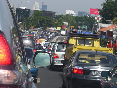
Car-crazy Jakarta fast descends towards total gridlock; Now disabled pedestrians should wear traffic signs

June 29, 2009 at 11:51 pm

(Source: AFP via Google, ITDP & Jakarta Post)

New laws requiring disabled pedestrians to wear traffic signs have met with frustration and derision in Indonesia, where in the eyes of the law cars have taken priority over people.

The laws will do nothing to improve road safety or ease the traffic that is choking the life out of the capital city of some 12 million people, and serve only to highlight official incompetence, analysts said.

Within five years, if nothing changes, experts predict Jakarta will reach total gridlock, with every main road and backstreet clogged with barely moving, pollution-spewing cars.

That’s too late for the long-awaited urban rail link known as the Mass Rapid Transit (MRT), which has only just entered the design stage and won’t be operational until 2016 at the earliest.

“Just like a big flood, Jakarta could be paralysed. The city’s mobility will die,” University of Indonesia researcher Nyoman Teguh Prasidha said.

Instead of requiring level footpaths and ramps, lawmakers voted unanimously this month to demand disabled people wear signs announcing their condition so motorists won’t run them down as they cross the street.

Experts say the new traffic law is sadly typical of a country which for decades has allowed cars and an obsession with car ownership to run rampant over basic imperatives of urban planning.

“It is strange when handicapped people are asked to carry extra burdens and obligations,” Institute of Transportation Studies (Instran) chairman Darmaningtyas said.

A 2004 study by the Japan International Cooperation Agency found that traffic jams cost Jakarta some 8.3 trillion rupiah (822 million dollars) a year in extra fuel consumption, lost productivity and health impact.

Paralyzing traffic jams and severe air pollution are the most frequent answers when people are asked what they know about Jakarta. Motorized vehicle ownerships increase in line with a rise in income per capita.

An Institute for Transportation and Development Policy (ITDP) study notes that motorized vehicle ownership is growing at 9 percent every year, with more than 1,500 new registrations being filed a day for motorcycles and 500 a day for cars.  The study discusses various options including BRT, incentives for biking, etc to manage the growing congestion problem that is now threatening to cripple the growth of the country’s economy and adversely affect the quality of life of its citizens.

Now, growth of the vehicle population is not the only problem.  The drivers behind the wheel are adding to the chaos on the roads.  An article that recently appeared in the online edition of Jakarta Post, says the following: Driving in Jakarta is nothing short of chaotic, thanks to the huge quantity of people using the roads, the often terrible condition of the roads and the vast variety of vehicles there are. All of this chaos is only made worse by drivers who are reckless and dismissive of other road users.

There are drivers that seem utterly oblivious to there being anybody else on the roads except themselves. Perhaps they are too comfortable in the enclosed air-conditioned capsule that is their vehicle, as they listen to pumped-up stereophonic music or even watch small video screens, to pay any attention or care about anyone else on the roads.

Click here to read the entire article.

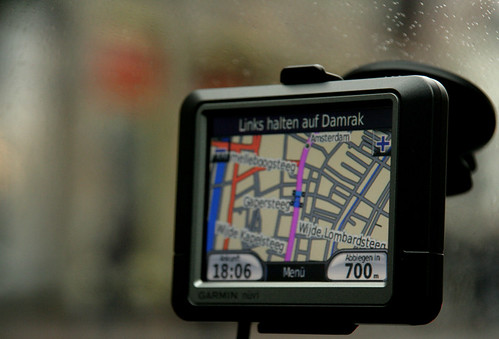
Navigation Device Gone Wild! American tourist in Germany follows outdated GPS into oncoming traffic

June 29, 2009 at 10:39 am

(Source: The Local, Germany)

Image Courtesy: Apture

An American tourist caused an accident near Karlsfeld over the weekend, banging up some €45,000 in damages when he followed an outdated navigation system prompt in the wrong direction, daily TZ reported on Monday.

According to the paper, the man’s Mercedes Vito rental car system had not been updated with the new exit from the B471 motorway near Karlsfeld, 20 minutes north of Munich.

The oversight caused him to drive himself and seven passengers into oncoming traffic, where they came face to face with a Peugeot. Both cars wound up veering off the road and into a ditch, the paper said.

The Vito landed on the roof, but all eight passengers in the Mercedes escaped injuries. The Peugeot driver suffered a whiplash injury.

Click here to read the entire article.

Smart Black Box – Coming Soon to a car next to you!

June 25, 2009 at 11:45 am

(Source: Wired)

Image Courtesy: Wired

A company that provides communications systems to law enforcement agencies around the world has developed a black box similar to those used in aircraft to record crash data in cars.

The Smart Black Box by KCI Communications sticks to your windshield and uses a built-in camera, GPS unit and G-force shock sensor to document accidents. The info could come in handy when trying to determine fault or explain to your insurance company just what happened when you crunched your car.  KCI says the GPS unit will record the time and location of an accident and document your speed and direction of travel. The company says that could be useful when trying to prove that red light you ran was actually yellow or in cases where you dispute the reading on a cop’s radar.

The Smart Black Box costs about $300 and constantly records video footage on a loop as you drive. Should the shock sensor detect an accident, the device saves the 15 seconds prior to impact and the 5 seconds afterward. The footage is saved to a SD Card, like that found in your digital camera, making it accessible on a home computer.

Click here to read the entire article.

Google’s Tentacles Unlock the Potential for Big Brother’s Foray into Unchartered Terrorities

June 24, 2009 at 4:09 pm

(Source: Daily Mail, UK & The Internet Patrol.com)

Candid Camera: Google Street View captures moment muggers prepared to pounce on teenage victim

Caught red-handed: This image taken by a Google Street View car shows the suspects following the boy down the street before he was attacked - Image Courtesy: Daily Mail Online

Dutch police have arrested two brothers on suspicion of robbery after their alleged victim spotted a picture of them following him on Google’s Street View.

The boy, 14, was mugged last September after two men dragged him of his bike in Groningen, 110 miles north-east of Amsterdam.

His attackers got away with around £140 and his mobile phone. Police were at first unable to track down the suspects.

But the victim contacted them in March after seeing what he believed to be an image of himself and the two men on Street View.

Officers got in touch with Google for the original picture because the people’s faces were blurred.  The company complied, and a robbery squad detective immediately recognised one of the brothers.

Prosecutors will now decide whether to charge the suspects, whose identities were not released.  Click here to read the entire Daily Mail article.

While this story has a happy ending (except for the twins), it does cause one to wonder just how far we are moving towards a big brother state.

Take, for example, this photo caught by the Google Street View camera:

Burgler Caught on Google StreetView Camera - Image via The InternetPatrol.com

Now, perhaps this is a cat burgler. Or perhaps it’s someone who locked themselves out of their house. Or someone just practicing their climbing skills.

If there are burglaries going on in the area, however, what do you think the odds are that this man is going to get hauled in for questioning?

That said, I think that the first big law suit – which could win – over invasion of privacy with respect to Google Earth, will be when a philandering spouse is caught by the other spouse because they happen to see a picture of the philanderer with their paramour on Google Earth, and a messy (and costly) divorce ensues. Or maybe when a wonderful birthday surprise is ruined because the intended giftee accidentally sees the person purchasing the gift during a moment of serendipitous Google Earth browsing.

Since it was launched in 2007, Street View has expanded to more than 100 cities worldwide.

But it has drawn complaints from individuals and institutions that have been photographed, including the Pentagon, which barred Google from photographing U.S. military bases for the application.

Mapping North Korean Railways Using Google Earth

An article that appeard on Wired about Google’s hallmark mapping software, Google Earth,  reiterates the above notion that such technologies can aid the big brother, not just on surface of the earth but also do that from miles above the earth.

For all the saber-rattling North Korea has been doing, precious little is known about daily life in the isolated nation. Even a railway map is close to classified information.

North Korean Subway Station - Image Courtesy: Wired

A doctoral student at George Mason University is using satellite images to get a closer look at a historically secretive country. North Korea is once again in the news because of its growing nuclear threat and the imprisoning of two American journalists. By closely examining Google Earth and corroborating physical evidence of infrastructure with reports from visitors and defectors, Curtis Melvin has assembled a workable map of North Korean railways — not to mention hidden palaces and outdoor food markets. The Google Earth overlays are available at his blog, North Korean Economy Watch.

“I am confident I’ve mapped over 90 percent of the system above ground,” Melvin told Wired.com. “There are probably still railway lines in low-resolution areas that I have not been able to find. Additionally, there are likely underground passages that I am unable to map, and the size of these I cannot guess.”

Since Kim Jong-Il is reportedly terrified of flying, Dear Leader travels on a luxurious private train that carries him between “on-the-spot-guidance opportunities.” That’s one thing for which we don’t blame him, considering the state of national airline Air Koryo. According to Melvin, there are special train tracks that carry VIPs to oases of luxury in the impoverished nation. “Several elite compounds have private train stations,” he said. “We can follow the railway lines through the security perimeters and into the elite compounds.”

Melvin has even managed to dig up some dirt on the inscrutable Pyongyang Metro — that’s the system’s Puhung station in the photo. Far from a Potemkin public transit system, the parts of the metro hidden from tourists seem to be less impressive but still functioning. “I have seen a couple of official pictures of other stations. They are much more spartan than the two shown to tourists,” Melvin said.

Click here to read the entire Wired Autopia article.