IntelliDriveSM Working Group Meeting – October 29 & 30, 2009 @ Detroit, MI

September 24, 2009 at 11:07 am

IntelliDrive - Safer, Smarter, Greener

The next *IntelliDriveSM Working Group Meeting will take place October 29-30th at the Doubletree Guest Suites Fort Shelby/Detroit Downtown Hotel.  The purpose of this meeting is for the major partners and stakeholders to present future plans and focus areas of the program and to discuss stakeholder involvement in all focus areas.  On the first day, each of the major partners (the states, auto industry, and USDOT) will discuss their upcoming plans, projects and focus areas. Day one will end with a facilitated discussion of the Working Group structure and stakeholder involvement to accommodate new focus areas including environmental applications, mobility applications based on various communications systems, and inclusion of aftermarket devices and applications.  Day two will include breakout sessions on specific focus areas for the program, including safety, mobility, and environment.

Who should attend?  The Working Group meeting will be open to members as well as other interested participants.

Date:  October 29-30, 2009 Oct 29th full day; Oct 30th half day, ending by 11:30 AM.

Location:  Doubletree Guest Suites Fort Shelby/Detroit Downtown Hotel.

525 West Lafayette Blvd, Detroit, Michigan, 48226

Tel: 1-313-963-5600

Registration:  Registration for this event is free.  However, a registration form must be completed by October 23 and sent to Brei Whitty at bwhitty@itsa.org in order to attend.

Click here for a registration form.

Hotel Info – Link

Airport to Hotel Transportation Information – Link

*IntelliDrive is a registered service mark of the US Department of Transportation. IntelliDrive was formerly known as the Vehicle-Infrastructure Integration (VII) program. More information about the program is available at www.intellidrive.org.

The Price You Pay…Market-based Road Pricing in the United States

September 21, 2009 at 10:56 pm

TransportGooru.com is proud to share this insightful presentation on market-based road pricing in the U.S. prepared by Mr. Glenn Havinoviski, a long time supporter of TransportGooru.com, for his recent discussion with the Public Policy program students at George Washington University in Washington, DC.

When Glenn updated his status message on LinkedIn after the classroom discussion, TransportGooru jumped on the opportunity to get a glimpse of his briefing material prepared for the class and wrote to him seeking permission to publish the briefing materials.  Glenn graciously agreed to share this excellent presentation and sent along a PDF version (shown in the PDF viewer below).   Please feel free to leave your comments/questions in the “Comments” section below and they will be brought to Glenn’s attention right away.   Thanks for sharing the presentation, Glenn.

About Glenn Havinoviski: Glenn currently serves as an Associate Vice President (Transportation Systems) at Iteris in Sterling, VA and is a registered PE.   Until recently, he was an Associate Vice President and ITS Group Director for HNTB Corporation in the Arlington, Virginia office. His 27 years of experience (25 in consulting, 2 in the public sector) include serving as both a practice builder and a practice leader, providing project management and technical leadership for ITS and traffic management projects in the US and abroad.Glenn N. Havinoviski, PE joined Iteris in Sterling, VA on July 6 as Associate VP, Transportation Systems, after serving as Associate Vice President and ITS Group Director for HNTB Corporation in the Arlington, Virginia office. His 27 years of experience (25 in consulting, 2 in the public sector) include serving as both a practice builder and a practice leader, providing project management and technical leadership for ITS and traffic management projects in the US and abroad.

NY Times outlines the difficulties facing re-authorization; Legislation for a 21st Century Transportation System Doesn’t Come Easy

September 17, 2009 at 12:53 pm

(Source: Greenwire @ New York Times)

According to a Center for Public Integrity report released yesterday, there are nearly 1,800 special interest groups lobbying Congress on the transportation bill, ranging from local officials and planning agencies to real estate companies, construction firms and universities. In the first half of this year, the groups employed more than 2,000 lobbyists and spent an estimated total of $45 million on their transportation lobbying.

The road to reforming the nation’s transportation systems looks to be a long and winding one.

Once lawmakers decide when to move forward with the sweeping overhauls they promise, they will need to find a way to pay for it. And once that difficult task is accomplished, the debate will only grow more complicated.

Many in the transportation community agree the next multi-year surface transportation bill needs to significantly boost federal funding for the nation’s roads, rails and bridges. But the consensus soon begins to crumble when the issue turns to how to pay for the overhaul — with lawmakers loath to tell Americans they will need to foot the bill and the rest of the transportation community agreeing that is the only option to pay for it (E&E Daily, Sept. 15).

But even off the Hill, where key players agree massive reform is needed to make the system more performance-based and effective, there is no consensus on exactly what that new system would look like and what those performance goals should be.

Many of the goals discussed at the invitation-only event are conflicting by nature. The usual suspects include the funding ratio for highways and transit systems, and the rate of return that individual states see from taxes they pay to finance the nation’s road and rail work.

Robert Atkinson, who chaired one of two congressionally created blue ribbon panels to examine transportation investment needs, said his panel, the National Surface Transportation Infrastructure Financing Commission, did not even broach the subject of where the increased investment should be spent in its report.

According to government estimates, the transportation sector accounts for roughly a third of U.S. carbon emissions, and Democrats have vowed to recast the nation’s roads and rails in a “greener” light.

But many state highway departments that had previously voiced support for the new environmental focus are now worrying that the emissions goals may grow overly ambitious and threaten to deliver another blow to both the economy and their efforts to repair and replace crumbling roads and bridges (Greenwire, Aug. 27)

Congress must also decide whether or not to welcome the private sector into the transportation field by giving firms long-term leases on public roads and bridges, effectively turning public infrastructure into a private product.

Click here to read the entire article.  For those wondering what is in the minds of our lawmakers drafting the reauthorization bill, here is congressman Oberstar’s handwritten scrap-paper version (pulled right from the House T&I Committee website, which has a lot of interesting materials to read on this subject).  Though it is not very detailed, it offers a general sensing of the direction he is taking (e.g., consolidating the existing behemoth (108 programs) into 4 categories to simplify the mgmt. structure, adding Office of Livability & Office of Expedited Project Delivery to the FHWA, etc.)

Agenda for Distracted Driving Summit Announced; Leaders Explore Solutions to Distracted Driving;

September 16, 2009 at 11:30 am
DOT Distracted Driving Summit 2009 logo

Image Courtesy: USDOT

(Source: USDOT Press Release)

U.S. Transportation Secretary Ray LaHood today announced the agenda  for the Distracted Driving Summit on Tuesday (shown below), September 30 and Wednesday, October 1. Over 200 safety experts, researchers, elected officials and members of the public will gather in Washington, D.C. to share their experiences, provide feedback and develop recommendations for reducing the growing safety risk that distracted driving is imposing on our nation’s roads.

The Distracted Driving Summit will bring together respected leaders from around the country for interactive sessions on the extent and impact of the problem, current research, regulations, best practices and other key topics. The two day Summit will feature five panels – on data, research, technology, policy, and outreach – with a range of experts discussing each topic.

  • The Summit will begin with a context setting panel where participants will examine the scope of the issue and the various distractions that exist, followed by a panel that will review currently available research.
  • Day one wraps up with an examination of distractions caused by technology and efforts made to assess and reduce negative effects caused by current and planned devices. Panelists will also consider technology that can prevent the consequences of driver distraction.
  • Day two features a review of legislative and regulatory approaches for dealing with distracted driving; evaluations of the impact of such measures; and enforcement issues. Members of Congress and their staff will also have the opportunity to contribute to the discussion.
  • Day two concludes with a discussion with teens about their experiences with distracted driving followed by an examination of various public awareness initiatives and research regarding the effectiveness of these efforts.

To accommodate the strong response, the Summit will be available live by webcast and members of the public will be given the opportunity to submit questions online for each individual panel discussion. The complete agenda and additional information about the Summit can be found at http://www.rita.dot.gov/distracted_driving_Summit/ .  Also, you can follow the latest developments via twitter @ distractdriving

————————————————————————————————————————————

Distracted Driving Summit
September 30 – October 1, 2009
Renaissance Hotel, 999 9th Street NW, Washington, DC

Agenda Is Subject to Change

Wednesday, September 30

DOT Welcome and Summit Opening
Peter Appel, Administrator
Research and Innovative Technology Administration

Opening Address
Ray LaHood, U.S. Secretary of Transportation

Panel: Driver Distractions and Inattention – Definitions and Data
A context-setting panel on the definition of distracted driving (what it is and what it is not), data on the extent of the issue, the types of distractions across surface modes of transportation.

Moderator:       Victor Mendez, Administrator, Federal Highway Administration

Speaker:           Dr. John D. Lee, Professor, Department of Industrial and Systems Engineering, University of Wisconsin-Madison
Speaker:           Kristin Backstrom, Senior Manager, AAA Foundation for Traffic Safety
Speaker:           John Inglish, General Manager, Utah Transit Authority
Speaker:           Bruce Magladry, Director, Office of Highway Safety, National Transportation Safety Board

Panel: Research Results – How Risky is Distracted Driving?

This panel session will review what various research – experimental research, industry self reporting, collision studies, and observational studies– tell us about the nature of the problem of distracted driving.

Moderator:       Rose McMurray, Acting Deputy Administrator, Federal Motor Carrier Safety Administration

Speaker:           Dr. Ann Dellinger, Lead, Motor Vehicle Injury Prevention Team,
Centers for Disease Control and Prevention, National Center of  Injury Prevention and Control
Speaker:           Dr. Tom Dingus, Director, Virginia Tech Transportation Institute
Speaker:           Dr. William Horrey, Chair, Surface Transportation Technical Group,
Human Factors and Ergonomics Society and Research Scientist,
Center for Behavioral Sciences, Liberty Mutual Research Institute for Safety
Speaker:           Dr. Key Dismukes, Chief Scientist, Human Systems Integration
Division, National Aeronautics and Space Administration Ames Research Center

Panel: Technology and Distracted Driving
This panel will focus on distractions caused by technology and on efforts that have been made (or are needed) to assess and reduce the negative impact of distractions caused by current and planned devices.  It will also consider technology that can prevent the consequences of distraction.

Moderator:       Peter Appel, Administrator, Research and Innovative Technology Administration

Speaker:           Dr. David Eby, Research Associate Professor and Head, Social
and Behavioral Analysis, University of Michigan Transportation Research Institute
Speaker:           Rob Strassburger, Vice President, Alliance of Automobile Manufacturers
Speaker:           Steve Largent, President and Chief Executive Officer, International Association
for Wireless Telecommunications Industry
Speaker:           Michael Petricone, Senior Vice President, Government Affairs, Consumer Electronics Association
Speaker:           Rod MacKenzie, Chief Technology Officer and Vice President of
Programs, Intelligent Transportation Society of America

Thursday, October 1

Congressional Presentation

Panel: Legislation, Regulation and Enforcement of Distracted Driving
This panel session will review legislative and regulatory approaches for addressing distracted driving; evaluations of the impact of such measures; enforcement issues; and public attitudes towards the issue.

Moderator:       Peter Rogoff, Administrator, Federal Transit Administration

Speaker:           John D’Amico, Representative, Illinois General Assembly
Speaker:           Bruce Starr, Senator, Oregon Senate and Executive Committee Member of the National Conference
of State Legislatures
Speaker:           Steve Farley, Representative, Arizona House of Representatives
Speaker:           Major David Salmon, Director, Traffic Services Division, New York State Police
Speaker:           Vernon Betkey, Chairman, Governors Highway Safety Association
and Director of the Maryland Highway Safety Office

Youth Program

Panel: Public Awareness and Education
This panel will review initiatives to increase public awareness of safety issues such as distracted driving, and will review research regarding the effectiveness of such efforts.

Moderator: Ron Medford, Acting Deputy Administrator, National Highway Traffic Safety Administration

Speaker:           Sandy Spavone, Executive Director, National Organization for Youth Safety
Speaker:           Chuck Hurley, Executive Director and Chief Executive Officer,  Mothers Against Drunk Driving
Speaker:           Ann Shoket, Editor-in-Chief, Seventeen Magazine
Speaker:           Janet Froetscher, President and Chief Executive Officer, National Safety Council
Speaker:           Dr. Adrian Lund, President, Insurance Institute for Highway Safety

Secretary LaHood
Closing Remarks and Action Plan

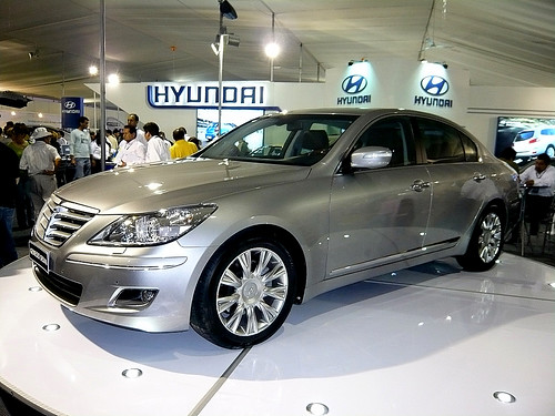
America’s love for Korean Hyundai! WSJ explores the reason why Hyundai is a hit in the US…

September 14, 2009 at 8:43 pm

(Source: Wall Street Journal)

Today’s WSJ had a nice article about the Korean Automaker, explaining what makes it a successful car in the US.   Worth a read..

….The leading Korean car company’s name rhymes with the first day of the week, as in “Hyundai, Bloody Hyundai.” Which is pretty much what the company’s competitors are saying to themselves these days about Hyundai’s remarkable success over the past few years.

Last year Hyundai’s global sales bucked the industry’s decline and rose 5% to 4.2 million cars and trucks. Even in the U.S., the world’s most competitive car market, Hyundai’s sales rose 0.8% in the first eight months of this year, while Ford’s sales dropped 25% in the same period and GM’s plunged 35%. The major Japanese auto makers suffered declines between 25% and 30%.

Hyundai’s success stems from a sustained corporate effort at reinvention—the very same word General Motors is using to describe its mission these days. The Hyundai story should provide GM with a road map.

For years, Hyundai enjoyed a protected home market in Korea. This ensured its prosperity there, but the lack of competition meant the company didn’t develop the product quality or consistency to compete effectively in international markets. The result: Hyundai’s initial U.S. success in 1986 was undercut quickly by quality problems.

A decade ago, Hyundai acquired Kia, a victim of a mid-1990s shakeout in the Korean auto industry. It also established a new quality-control division charged with boosting reliability by emulating Toyota’s vaunted manufacturing methods. To allay lingering concerns over quality, Hyundai put warranties of 10 years or 100,000 miles on vehicles sold in America.

Their campaign began to show results, and the big breakthrough came in 2004, when Hyundai tied Honda for second place in the prestigious J.D. Power & Co. Initial Quality Survey. Also that year, Hyundai completed its first U.S. assembly plant, near Montgomery, Ala.

On the marketing front, last January the Hyundai division launched an innovative “Assurance Program” in the U.S.: Buyers return their cars if they lose their job within a year after their purchase. The offer generated buzz and resonated with the public, as Hyundai’s recent U.S. sales results demonstrate, even though buyers have turned in fewer than 50 cars under the program, which continues through year-end.

…..Both U.S. companies will have to make their marketing more relevant. Hyundai’s 10-year warranties and the “Assurance Program” succeeded because they addressed specific customer concerns—the former about the brand’s reliability, the latter about the economic environment…….

Click here to read the entire article.

Fourth Annual International Airport Geographic Information Systems Conference – October 6-8, 2009 @ Manchester, England

September 11, 2009 at 12:13 am

Fourth Annual International AAAE Airport Geographic Information Systems (GIS) Conference

General Information

The International Association of Airport Executives (IAAE), the American Association of Airport Executives (AAAE) and Manchester International Airport are pleased to present the Fourth Annual International Airport Geographic Information Systems Conference October 6-8, 2009 in Manchester, England. Following the first three successful conferences, which drew more than 175 attendees from 25 countries, the fourth conference promises to be an educational experience you will not want to miss!

By attending this conference, the only one in the world dedicated to airport GIS, you will learn from European, American, African and Asian airports how and why GIS is being used at large and small airports, as well as the ways in which GIS has made airports safer and more efficient. Airports from all corners of the world, new to GIS or experienced with GIS implementation, are welcome to participate, as well as anyone interested in GIS and aviation!

The conference includes:

  • GIS-related airport tour of Manchester International Airport
  • Diverse array of airport GIS-related presentations/demonstrations from airport GIS personnel, government officials, consultants and vendors
  • Exhibit opportunities
  • Sponsorship opportunities

All sessions, with the exception of the airport tour, will take place at the Renaissance Manchester Hotel. The conference will begin with registration and the welcome reception at 1830 on Tuesday, October 6. The general session will begin at 830 on Wednesday, October 7 and conclude at 1700 on Thursday, October 8. The registration fee includes all handout materials, the welcome reception, two luncheons and all coffee breaks. Dress is business attire. The Web site for the Renaissance Manchester Hotel is:www.renaissancemanchester.co.uk.

Click here for more details.

Event Alert! IBEC Seminar: Road Pricing – Beyond the Technology — September 20, 2009 @ Stockholm, Sweden

September 4, 2009 at 2:20 pm
IBEC Day Seminar
Road Pricing Beyond the Technology
Sunday 20 September, 2009
9:00-17:00

Radisson SAS Royal Viking Hotel
Vasagatan 1 (near Central Station) SE-101 24 Stockholm (Sweden )

Key Issues
– What are the economic benefits of road pricing and how can they be measured?
– Can road pricing provide large scale and long-term economic stimulus for a 21st Century economy?
– How should we inform and consult with stakeholders?
– What about social equity – do we understand the social distribution of costs and benefits?
– How should we manage politics and public expectations?
– Are HOT lanes a step in the right direction or a dangerous distraction?
– What have we learned from current efforts at implementation?
– Where have real benefits been delivered and what have we learned from the failures?

Registration
The registration fee is
Euros 75 (incl. taxes) and includes a buffet lunch and three coffee breaks.
An up-to-date programme and a registration form are available via the link “see attachment” below.
Registrations can be made either by email or fax. On-site registrations are also possible if seats are available.
Contact:
Mrs Odile Pignierodile@harmonised-events.com – Tel: +33 2 41 54 76 30 – Mob: +33 6 79 76 47 66

See Website
See attachment
See Access Map Details

Is your community ready to support an “electric car future”? Seattle PI explores Seattle’s infrastructure readiness to support electric vehicle proliferation

August 31, 2009 at 4:58 pm

(Sources: Seattle PI via Autobloggreen)

With more and more electric car makers ready to blitz the market with Plug-in Hybrids Electric Vehicles and Plug-In Electric Vehicles, it is time the local communities took a stock of the supporting infrastructure necessary for feed these voltage-hungry vehicles.  The Seattle PI takes a look at the readiness of Seattle to handle the surge of electric vehicle.   Here are some interesting excerpts from the article:

Is Seattle charged for electric cars? Local electric car boosters think so, event though electric cars — other than such hybrids as the Prius — have not captured the fancies of more than a few people in the past 20 years.

“There’s a perfect storm this time around,” said Steve Lough, president of the Seattle chapter of the Electric Vehicle Association, who drives a 2000 Honda insight gas-and-electric hybrid.

On Aug. 5, the federal government announced that it will provide almost $100 million to install roughly 2,500 electric vehicle chargers each in the greater metropolitan areas of Seattle, Phoenix, Nashville, Portland and San Diego.

Roughly $20 million will go to Seattle for 2,550 chargers, Read said.

About 40 firms, including Nissan and eTec, will match the federal appropriations. Local governments will not be required to provide matching money, Read said.

This experiment is timed with Nissan’s planning to sell a new electric car — the “LEAF” — in late 2010. It hopes to initially sell 5,000 cars evenly split among the five metro areas.

This timing roughly coincides with General Motors’ plans to put possibly 10,000 of its all-electric “Volt” cars on the market in late 2010.

By comparison, Seattle has the nation’s largest chapter of the Electric Vehicle Association — with 230 members.

Local owners said recharging electric cars lead to different habits from refueling conventional vehicles.

“You basically plug it in whenever you park it,” said Dan Davids, owner of a 2002 Toyota RAV4-EV and president of the nationwide Plug-In America organization.

Fulling charging a car with a conventional 220-volt installation could take four to eight hours. So-called “fast” chargers with extra oomph could take 15 to 30 minutes to do the same.

But local electric car owners said those figures are misleading.

These cars rarely need full charges with the accompanying long repowering times, they said.

Electric cars are usually charged nightly at their homes. If recharged at business locations, the new power mostly “tops off” a battery usually containing most of its original charge, they said. The same “topping off” would occur when cars would be recharged at businesses.

Between the small amounts of electricity and the lack of wear-and-tear on moving engine parts, they estimated it costs about 2 cents a mile to operate their vehicles.

The three are optimistic that a major hurdle to owning electric cars could be finally conquered — the initial price tag. The Tesla Roadster — with about 700 sold so far — goes for $109,000. Many models of electric cars have been in the $50,000 to $100,000-plus range. “You’re financing the research and development for the next generation of technology,” Morrison said.

The Volt’s expected price tag is about $40,000 with a federal tax credit of $7,500 earmarked for early buyers. The same tax credits will go to buyers of the first LEAFs, which are expected to go for $25,000 to $33,000.

Click here to read the entire article.

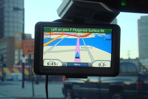
Study says GPS-systems with real-time traffic info can save a lot of time

August 30, 2009 at 11:54 am

(Source: NAVTEQ via Autoblog)

According to a new study, GPS-systems with real-time traffic info can save American drivers four days a year of being stuck in grizzly traffic snarls. As promising as it sounds, this particular study should be viewed with a little bit of skepticism because it was sponsored by navigation systems data-provider NAVTEQ.  Here are some of the study details (as published in the NavTeq press release).

The results are from a three pronged studies conducted in two metropolitan areas of Germany – Dusseldorf and Munich — which evaluated drivers without a navigation system, drivers with a navigation system, and drivers with a navigation system that included real-time traffic. Previous studies in this field focused more on “getting lost” scenarios versus the benefits to drivers of navigation system use during the course of their normal driving habits.

The study revealed that the drivers using traffic enabled navigation devices experienced dramatic time savings, spending 18% less time driving on an average trip versus drivers without navigation. If applied over the course of a year, a driver who does not currently use a navigation device would save themselves 4 days of driving each year if they had a traffic-enabled navigation system. Additionally, the findings show that drivers with real-time traffic experience reductions in distance traveled as well as increase fuel efficiency which would lead to a decrease in CO2 emissions per driver of .79 metric tons, or 21% less than a driver without a navigation system.

These results not only point to the positive impact on German drivers, they can be projected to other countries as well, for example*:

  • UK drivers with traffic enabled navigation would save 2.5 days per year and drop their CO2 emissions by 20%
  • US drivers with traffic enabled navigation would save 4 days per year and lower their CO2 emissions by 21%

Click here to read the entire press release.

Google maps makes inroads into live traffic data market; Adds live traffic conditions data for arterial roads

August 25, 2009 at 5:27 pm

(Sources contributing to this hybrid report:  CNET; Ars Technica; LifeHacker; eweek-Google Watch)

In the movie business, the  blockbusters are often reserved for the summer months.  Just like the movie-makers, the Googlers are making it a habit to unveil some of their coolest products over the summer months and this year is no exception (as if they are not doing anything cool during the rest of the year).

The Google Maps team has been on quite the tear this summer, enriching its platform and beefing up location-based services, such as Google Latitude. In just the past two months, the search and Web services giant has offered multiple searches for one search destination session, shown users how to get Google Maps on Web sites, and offered a Street View tutorial.  Now they are at it again – this time with another awesome feature: live traffic updates for arterial roads in addition to the data it already offers up for major highways.

Google Maps is adding traffic data for side streets starting today, which combined with a the data it already offers up for major highways makes it a “must-have” tool for all roadwarriors. Major “arterial” roads, such as state highways or prominent boulevards in cities, will now have their own color-coded traffic information in Google Maps, giving drivers the option of selecting an alternate route based on current traffic conditions.

Image Courtesy: LifeHacker

So how is Google expanding its traffic reports to side streets? If you’re using Google Maps on your smartphone (with the notable exception of the iPhone, which doesn’t support the feature, according to Google) you’re automatically sending speed data back to Google wherever you go.

The trigger is the “My Location” button in Google Maps, which automatically signs you up for the traffic crowdsourcing program when that button is pressed. In addition, Palm Pre and MyTouch 3G users are automatically enrolled in the traffic crowdsourcing program.

You can opt out of the program, but at the expense of the My Location feature. Hit the “My Location” button again to figure out where you are in an unfamiliar city, and you’re automatically re-enrolled in the program.

Traffic data has been available on major highways for years through Google Maps, but that data is collected from road sensors and private car fleets and is also available to dozens of third-party traffic providers. The number of people using GPS-enabled smartphones with Google Maps installed has dramatically increased since 2007, and many of them may not know that by using the My Location feature, they’re also participating in a traffic-related survey.

MSFT HQ Map.png

Image Courtesy: Google Watch (Eweek) - Traffic conditions snapshot around Microsoft headquarters, Seattle

This is a fantastic feature (assuming you don’t mind the anonymous usage statistics going to Google), and one that’s actually available in some GPS devices already. The drawback on some devices—the iPhone, for example—is that you’d need to use Google Maps in place of another GPS application, and since the iPhone now features turn-by-turn GPS navigation applications, it’s a bit of a sacrifice. Still, if Google were to go the extra mile and turn Google Maps into a turn-by-turn GPS app (something that seems well within reason, considering how much map data they’ve already got), then they’d really be on to something that a lot of us would potentially use.

Not only can you get live traffic updates, Google Maps lets you select options for viewing the average traffic patterns on a specific day and time. Say you’re taking a road trip and you’re leaving on Thursday at 5pm—you can now look up the traffic in advance for planning purposes (see image below to the right).

gmaps_trafficchoices_ars.png

Image Courtesy: Ars Technica

In addition to the arterial road information, Google has also begun using crowdsourced data for traffic information. If you use Google Maps for mobile with GPS enabled, you can choose to allow Google Maps to send regular updates (anonymously, of course) about where you are and how fast you’re moving.

“When we combine your speed with the speed of other phones on the road, across thousands of phones moving around a city at any given time, we can get a pretty good picture of live traffic conditions,” wrote Google. “We continuously combine this data and send it back to you for free in the Google Maps traffic layers.”

Google assures users that they only use anonymous speed and location information to calculate traffic conditions, and only do so when the user has opted to enable location services on his or her phone.

The problem with the location-based services is that it affects a skittishness in people. Concepts like location-based services that send “bits of data back to Google” tend to make people nervous. Electronic Frontier Foundation has a great report on the intersection of location services and privacy.

“We understand that many people would be concerned about telling the world how fast their car was moving if they also had to tell the world where they were going, so we built privacy protections in from the start,” wrote Dave Barth, product manager for Google Maps. “We only use anonymous speed and location information to calculate traffic conditions, and only do so when you have chosen to enable location services on your phone.”

Click here to read the entire article.